How satellite connectivity is transforming yacht charter
In the boat rental industry, every boat that leaves port represents both a business opportunity and an operational risk. How can you ensure that your customers respect the authorized navigation zones? How can you react quickly to emergencies on the high seas? How can you optimize your fleet management and reduce your insurance costs?
The answer to these questions lies in a technology that is revolutionizing the marine rental sector: satellite geolocation.
Daily Challenges for Yacht Charter Operators
If you manage a fleet of rental boats, you're well aware of the problems that can turn a promising season into an operational nightmare.
Loss of Visibility on the High Seas
Your current tracking systems work perfectly as long as your boats stay close to shore. But as soon as a tenant decides to explore a more remote island or sail to an isolated bay, your craft disappears from radar. This loss of visibility can last for several hours, leaving you in total uncertainty as to the position and status of your asset.
The problem: Cellular systems only cover about 15% of sea areas. The remaining 85% are blind spots where you're sailing blind.
Non-compliance with Authorized Zones
You've defined authorized boating zones for safety, insurance and regulatory reasons. But how do you check that your tenants respect these limits? Without a reliable tracking system, you often only find out after the fact, when an incident has already occurred.
The risk: Sailing in dangerous areas, overstepping territorial limits, entering protected marine areas leading to fines, invalidation of insurance coverage.
Impossibility to intervene in case of emergency
When a charterer encounters a problem at sea - engine failure, adverse weather conditions, medical emergency - every minute counts. But if you don't know exactly where your boat is, how can you organize fast, efficient assistance?
The consequence: Longer response times, higher intervention costs, lower customer satisfaction, and in serious cases, danger to those on board.
Inefficient Fleet Management
Without real-time visibility of your entire fleet, planning becomes a headache. Which boat will be back in time for the next charter? Which needs urgent maintenance? Where exactly are your boats at the moment?
Impact: Sub-optimal optimization of rotations, downtime between rentals, reactive rather than preventive maintenance, loss of revenue.
High insurance costs
Insurers consider yacht charter to be a high-risk business. Without a robust monitoring and control system, your insurance premiums remain high, putting a strain on your profitability.
The financial burden: Insurance premiums can account for 15 to 25% of your annual operating costs.
The Satellite Solution: A Complete Transformation of Your Business
Satellite geolocation offers a complete and integrated response to all these challenges. Let's take a look at how this technology is transforming the day-to-day management of a rental fleet.
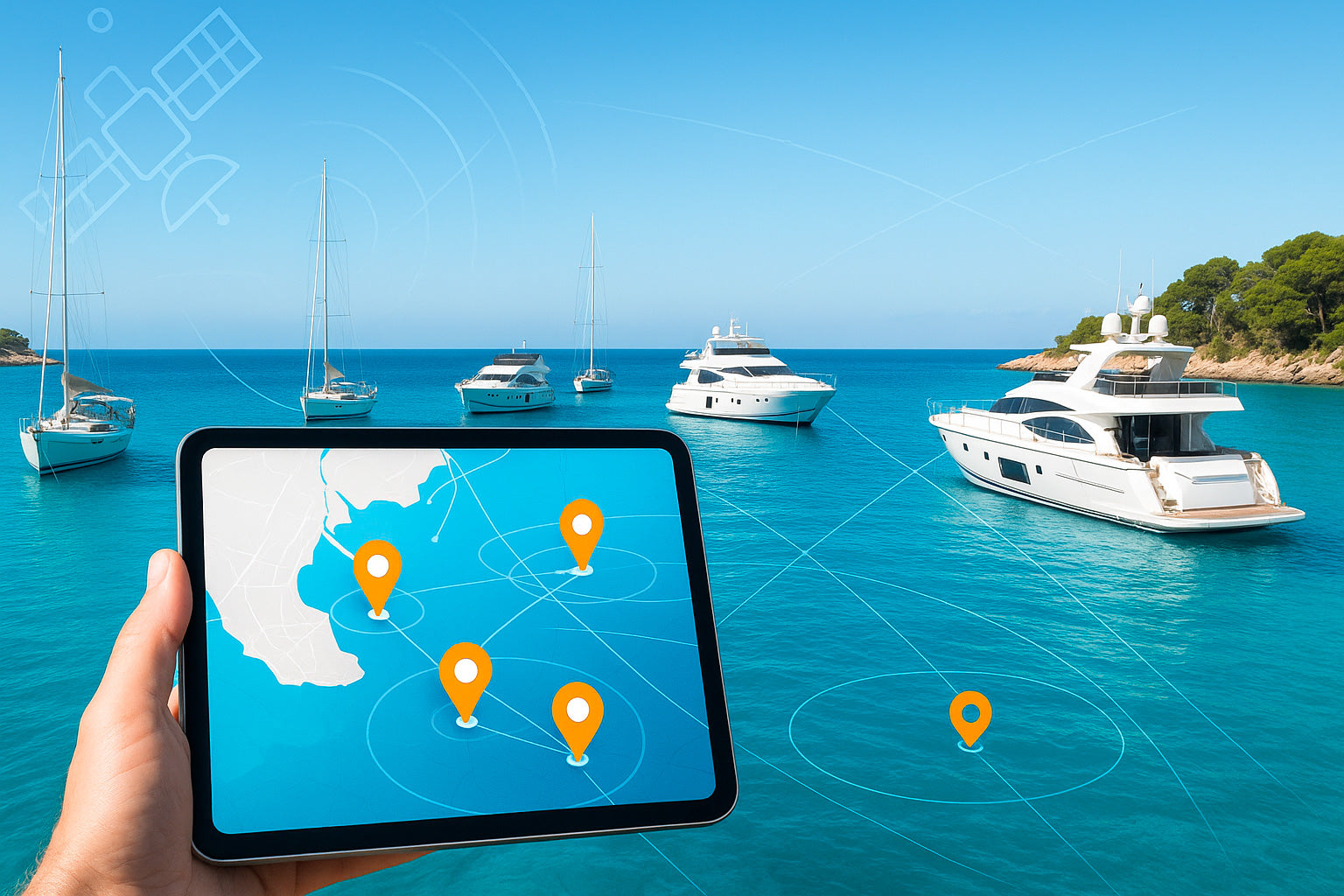
Total Visibility, Everywhere, All the Time
Worldwide coverage with no blind spots
Unlike cellular systems, satellite connectivity covers 100% of maritime areas. Whether your boat is sailing close to the coast, exploring a remote island, or crossing to a distant destination, you'll always have visibility.
Real-time Tracking
View the exact position of each boat in your fleet on an interactive map at any time. You know exactly where your assets are, in which direction they're moving, and at what speed.
Complete trip history
Access detailed trip histories for each boat. This traceability is invaluable for resolving disputes, checking compliance with rental conditions, and optimizing your recommended itineraries.
Intelligent Geofencing: Control Navigation Zones
Defining custom zones
Create authorized sailing perimeters adapted to each type of boat and each renter profile. You can define different zones according to the skipper's experience, weather conditions, or your insurance requirements.
Automatic alerts in the event of overruns
Receive instant notification if a boat leaves the authorized zone. You can then immediately contact the renter and ask them to return to the defined perimeter, avoiding risks and insurance problems.
Danger zone prevention
Set up exclusion zones corresponding to dangerous reefs, prohibited navigation zones or marine protected areas. The system alerts you if a boat approaches these risk zones.
Enhanced Assistance and Safety
Precise Tracking for rapid intervention
In the event of an emergency, you immediately know the exact position of the boat in difficulty. This information enables you to organize a targeted and rapid intervention, whether by your own teams or by the sea rescue services.
Two-way communication
Modern satellite devices enable two-way communication. You can send messages to your tenants, even on the high seas, to inform them of a change in the weather, give them instructions, or simply check that everything is running smoothly.
Integrated SOS button
Some systems include an emergency alert function that tenants can activate in the event of a serious problem. You receive an instant alert with the exact location, enabling you to react immediately.
Fleet Management Optimization
Real-time overview
View your entire fleet on a single dashboard: charter boats, boats in port, boats under maintenance. This global view facilitates planning and decision-making.
Precise return forecasts
Thanks to real-time tracking, you know exactly when each boat will be back in port. This information enables you to optimize rotations and inform subsequent customers precisely.
Predictive maintenance
Navigation data (engine hours, distance traveled, operating conditions) enables you to plan maintenance preventively rather than reactively. This reduces unplanned breakdowns and extends the life of your equipment.
Usage statistics
Analyze your fleet's usage patterns: which boats are most in demand, which areas are busiest, which periods are busiest. This data helps you to optimize your offer and sales strategy.
Measurable results for your business
Yacht charter companies who have adopted satellite geolocation are seeing concrete, quantifiable benefits.
Drastic Incident Reduction
75% reduction in zone exits
The simple fact that renters know their boat is being tracked encourages compliance with the rules. Automatic alerts enable immediate action to be taken if the rules are exceeded, quickly returning boats to the authorized zones.
60% drop in emergency interventions
Proactive prevention and the ability to communicate with tenants in real time significantly reduce the number of emergency situations. When intervention is necessary, it's quicker and less costly thanks to precise Tracking .
Operational Optimization
40% improvement in turnover rate
Real-time visibility and precise return forecasts optimize rotations between rentals. You'll reduce downtime and increase the number of rentals per boat per season.
Reduces unscheduled maintenance costs by 50%.
Predictive maintenance based on actual usage data helps to anticipate needs and avoid costly breakdowns at the height of the season.
Insurance savings
20-35% reduction in insurance premiums
Many insurers offer significant discounts for fleets equipped with satellite geolocation systems. The ability to prove compliance with authorized zones, and to react quickly in the event of an incident, reduces the risk profile of your business.
Rapid dispute resolution
Geolocation data provides objective evidence in the event of a dispute with a tenant or insurance company. This traceability speeds up resolution and protects your interests.
Improving Customer Satisfaction
Peace of mind for tenants
Knowing that they can be located and assisted quickly in the event of a problem reassures your customers, especially those with less experience.
Proactive communication
The ability to send weather alerts or recommendations during rental enhances the customer experience and reinforces your image of professionalism.
A differentiating selling point
The enhanced security offered by the satellite geolocation system becomes a selling point that sets you apart from the competition.
A quick return on investment
Adopting a satellite geolocation system represents an investment, but the returns are many and rapid.
Controlled costs
Affordable, stand-alone devices
Modern satellite trackers, like the SmartOne Solar, offer simple installation with no cabling, and energy autonomy thanks to integrated solar panels. The cost per boat quickly pays for itself.
Flexible subscriptions
Satellite subscription packages are tailored to the needs of professional rental companies, with seasonal or annual billing options.
Fast return on investment
Direct savings
-
Reduction in insurance premiums: 20-35%.
-
Reduction in emergency response costs: 60%.
-
Reduced unscheduled maintenance: 50%.
Indirect gains
-
Increase in turnover: +40%.
-
Reduced litigation and losses from uninsured damage
-
Reputation enhancement and customer loyalty
Typical return time: 12 to 18 months
For a medium-sized fleet, the investment in satellite geolocation generally pays for itself in one or two seasons.
Testimonial: A Mediterranean rental company
"Before we installed the satellite geolocation system, we regularly had boats venturing outside our authorized zones. We often found out too late, sometimes after an incident. Today, we have total visibility over our fleet of 25 boats. Automatic alerts enable us to intervene immediately. Our insurance premiums have dropped by 30%, and we haven't had a single major incident in two years. The system paid for itself in less than a year."
- Sailboat rental company manager, Côte d'Azur
How to get started
Implementing a satellite geolocation system for your rental fleet is easier than you think.
Step 1: Assess Your Needs
Identify your priorities: security, zone control, fleet optimization, insurance cost reduction? Each company has its own specific needs, which will influence the choice of solution.
Step 2: Choosing the right device
Select satellite trackers adapted to your fleet type. For boats from 8 to 25 meters, stand-alone solar-powered solutions offer the best value for money and ease of installation.
Step 3: Quick installation
Installation generally requires no complex wiring. A device can be installed in less than 30 minutes per boat.
Step 4: Platform configuration
Define your authorized navigation zones, configure your alerts, and customize your dashboard according to your operational needs.
Step 5: Building your team
Train your staff to use the management platform. The intuitive interface makes it easy to learn.
Step 6: Communicating with your customers
Inform your tenants of the presence of the geolocation system. This transparency builds trust and encourages compliance.
The Future of Yacht Charter
Satellite geolocation is just the beginning of a broader digital transformation of the marine rental sector. The data collected paves the way for future innovations:
Artificial intelligence and prediction
Machine learning algorithms will be able to analyze navigation patterns to predict maintenance needs, optimize recommended routes, and personalize the customer experience.
Integration with reservation platforms
The connection between geolocation systems and online booking platforms will enable even smoother, more automated management.
Enhanced customer experience
Renters will be able to access mobile applications that allow them to check their position, receive route recommendations and access geolocated tourist information.
Conclusion: Don't sail blind any more
In a sector as competitive as boat rental, every operational advantage counts. Satellite geolocation simultaneously offers you :
-
More security for your assets and customers
-
More control over your fleet and operations
-
Greater efficiency in day-to-day management
-
More profitability thanks to savings and optimization
Charterers who embrace this technology today are getting a head start on the competition, and positioning themselves for success in the digital future of marine charter.
Don't let your boats sail out of sight. Take total control of your fleet with satellite geolocation.
Konectis : Your Partner for Maritime Satellite Geolocation
Konectis offers comprehensive satellite geolocation solutions specially designed for boat rental professionals. Our platform combines robust tracking devices, global satellite connectivity and an intuitive management interface.
Request a personalized demonstration and find out how we can transform your fleet management: www.konectis.com
Simple installation - Worldwide coverage - Expert support - Fast ROI